Explore the Byway
The St. Croix Scenic Byway follows a route established in 1855 between Point Douglas, Minnesota and Superior, Wisconsin. Although intended as a highway for troop movement, the road quickly attracted a flood of civilian and commercial traffic. The 124 mile Byway route passes through three Minnesota counties: Washington, Chisago and Pine. Today, the cities along the route offer visitors unbeatable scenery, a range of activities and a variety of businesses to explore.
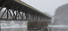
 The Washington county area of the byway runs North from Point Douglas and Great River Road. Points of interest include Afton State Park, the historic Boom Site near Stillwater and William O’brien State Park.
Cities to visit:
 The byway continues North to Chisago County past Franconia Township, Interstate State Park, the National Park Service Riverway Headquarters, Wild Mountain Road, and Wild River State Park.
Cities to visit:
- Taylors Falls
- Sunrise
- Rush City
 The Northernmost county along the Byway is Pine County. Within Pine County you will find St. Croix State Park, Banning State Park and the Veterans Evergreen Memorial Scenic Drive.
Cities to visit:
- Rock Creek
- Pine City
- Hinckley
- Sandstone
- Askov
General Information
- St. Croix National Scenic Riverway Web Site
- National Park Service Book: Time and the River:
A History of the Saint Croix
Maps
